With so much unknown about which way water flows, we turned to making a model to explain how this works. We pulled out a tablecloth and some spray bottles to create Chicago's landscape, which is pretty flat.
 | We noticed that the water didn't flow at all when the surface below the water was completely flat. However, we do know that the water actually flows, so that must mean that the surface below the river is actually on a tilt (or slanted or somewhat of a hill...) |
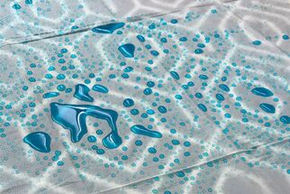
So we put a whole bunch of things UNDER the tablecloth to create areas of higher elevation and areas of lower elevation. We recognized that Chicago's landscape doesn't look like this (we made some mountainous areas for sure!), but the different heights of the land helped us see that these differences in how tall the land is affects how the water flows on it.
| | Changing the structure of the landscape helped us really see how water flows. We saw water flowing differently based on how "tilted the land was. Areas that were higher had water that flowed faster. Areas that were more flat (but still tilted somewhat) flowed slower. |
We recognized that this didn't answer our wondering about which way the Chicago River flows (into or away from our suspected drinking water source of Lake Michigan). So we're thinking that someone has to measure how "tall" the land is or how deep various bodies of water are. In fact, some students suggested that there are elevation readings recorded to tell us how high places are compared to others. Something like "above sea level."
Mrs. Brinza has committed to finding elevation data for areas in Chicago! Check back soon as we figure this out!
Mrs. Brinza has committed to finding elevation data for areas in Chicago! Check back soon as we figure this out!
 RSS Feed