With all that we figured out, we celebrated the end of our Mt. Everest unit by focusing on four questions that drove our learning! And to have some fun, we may have made some Mt. Everest memes. Way to go 6th graders!
|
Now that we know the top of Mt. Everest is covered in the same type of rock and fossils found typically on a seafloor, we see how much of it is gone. How can this be? We're suspecting erosion, but how does that really work with really strong rock? We've seen examples of this before in other landscapes around the world, so we think there are many examples of this all over the globe!
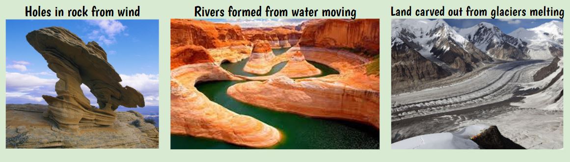
We are noticing that the change is small and takes a bit of time (the glacial video was a timelapse) and the pieces of sand coming off the dunes are tiny. But if we add up a lot of little pieces over a long period of time, it certainly seems like the top of a mountain can certainly "disappear!" Students were asked to model this process over millions of years to today.
Even though we're asynchronous this week due to state testing, students are seeing how we can combine ideas from various models to showcase our thinking of two things:
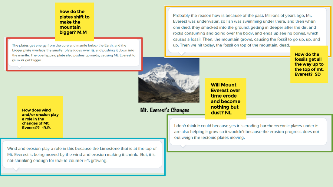
The mountain is certainly not the same it was millions of years ago, and there's definitely evidence to suggest it's moving different directions as well as looking different! Now that we see how mountains can be changing in so many ways due to so many factors, it looks like we can return to our DQB and celebrate all that we've figured out! 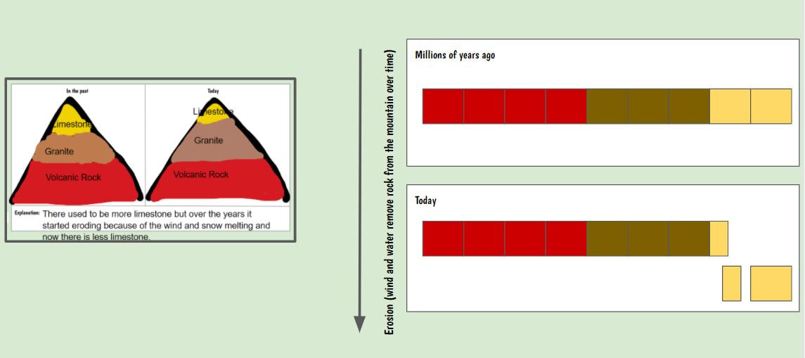
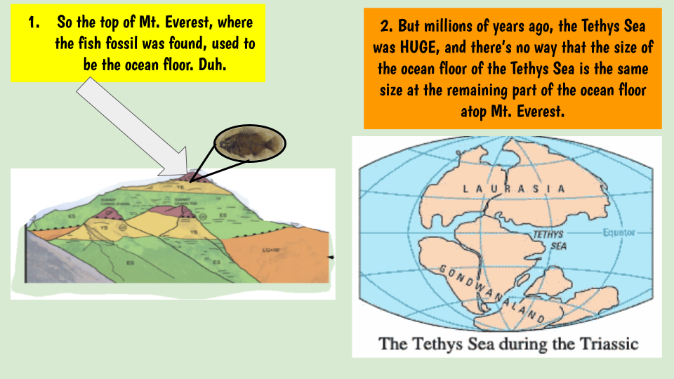
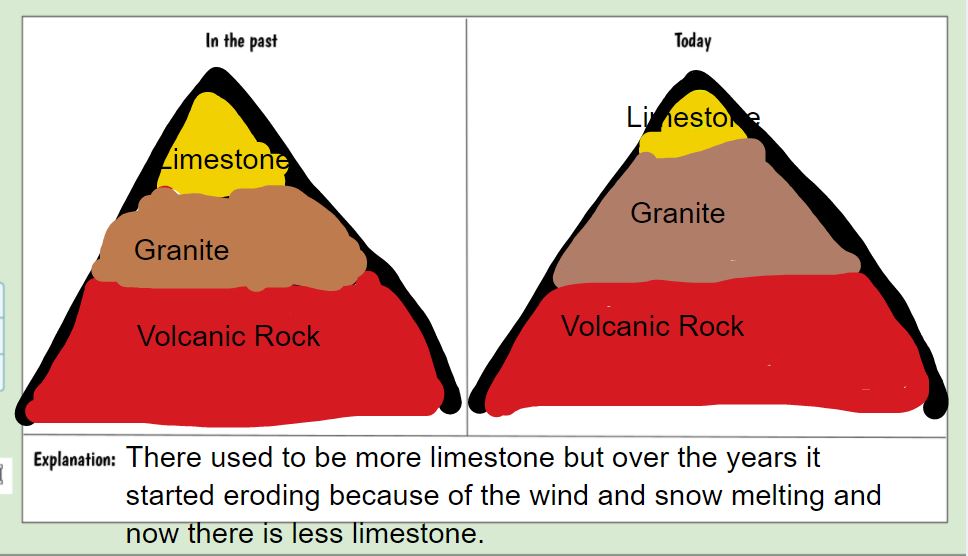
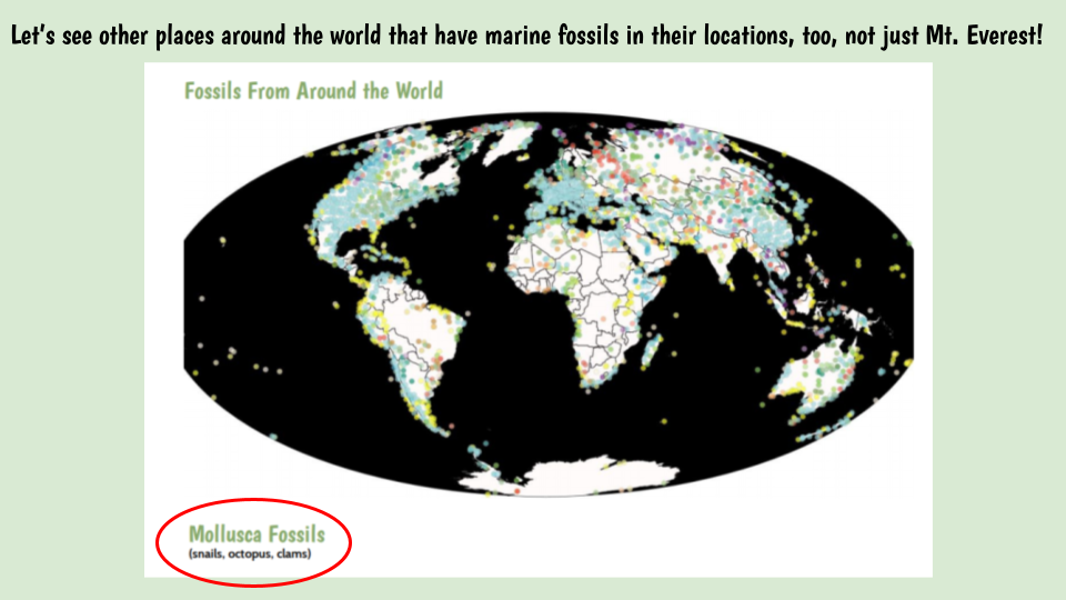
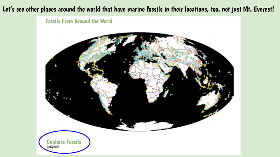
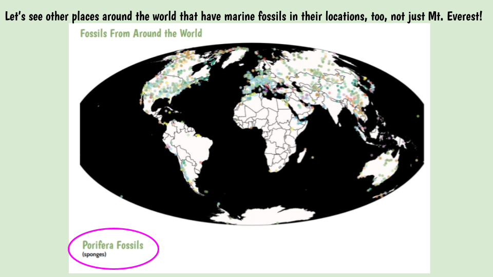
Recognizing that the top of Mt. Everest is made of limestone, we're seeing how this is really interesting because limestone derives from shells, which are found on the bottom of the ocean floor. Was the top of Mt. Everest once the bottom of an ocean? We've got some figuring out to do! Looking at some fossil maps from all over the world, we began to see some patterns:
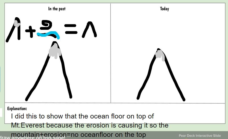
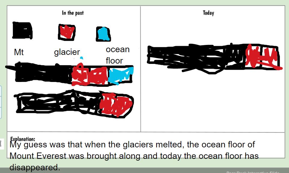
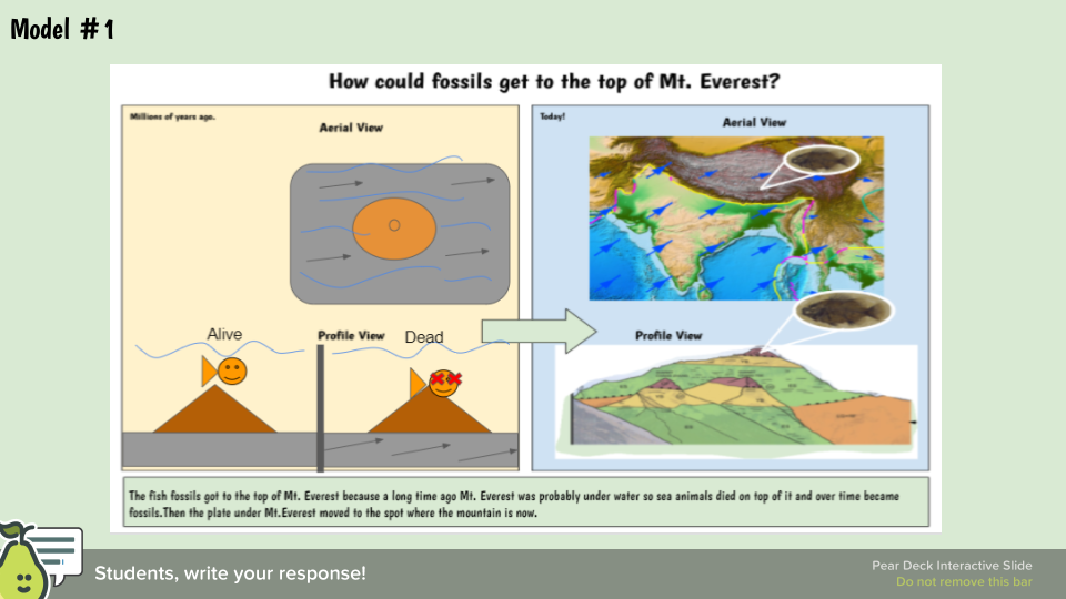
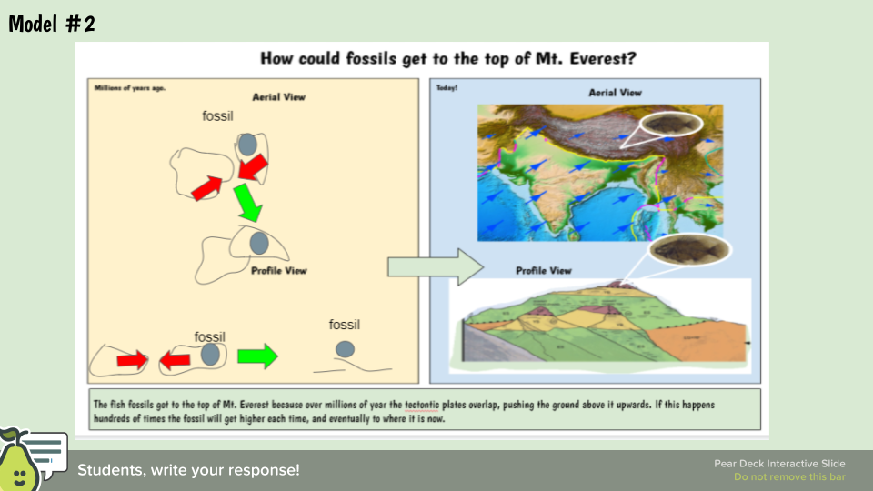
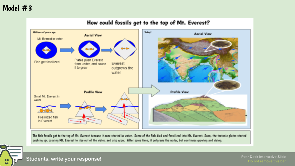
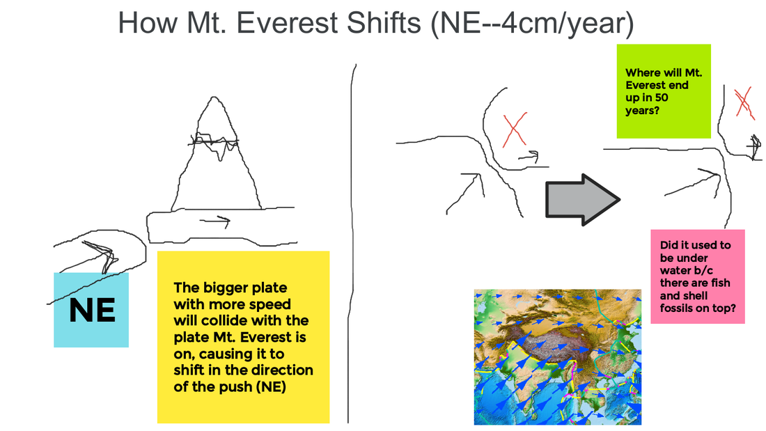
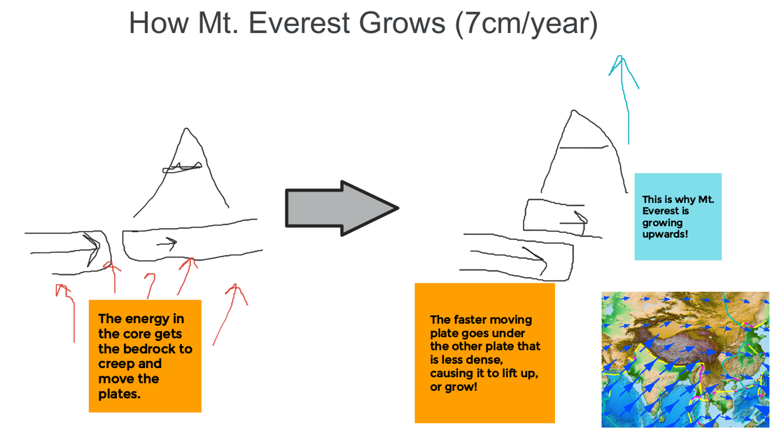
It looks like lots of places all over the world have aquatic fossils on them, just like the top of Everest! Students were asked to model how this could have happened, especially knowing that GPS data is suggesting Mt. Everest is getting taller and shifting to the NE annually. Check out these three students' work:
We're thinking that the plates must have been moving and in totally different places millions of years ago (knowing they move cm/year). Since we've also figured out how plates can lift one another up, we think that this is now fossils that were once on the ocean floor (we did some figuring out about how they form in the first place) can then be higher up in say, a mountain!
Our thinking agrees with the thoughts of other scientists! Now we're onto to explaining why so little of Mt. Everest's seafloor is left on the top!
So what exactly is causing that seafloor atop Mt. Everest to shrink!?!?!
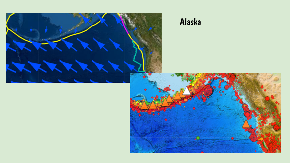
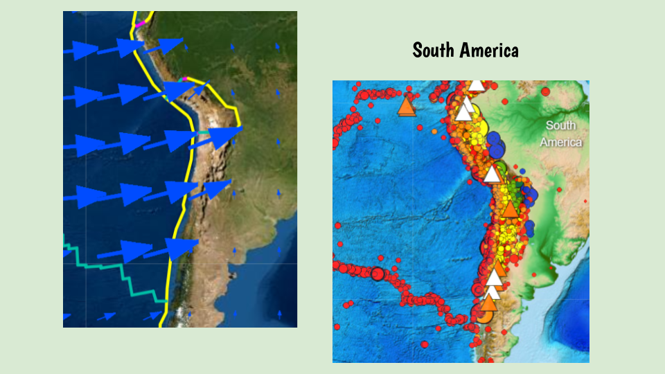
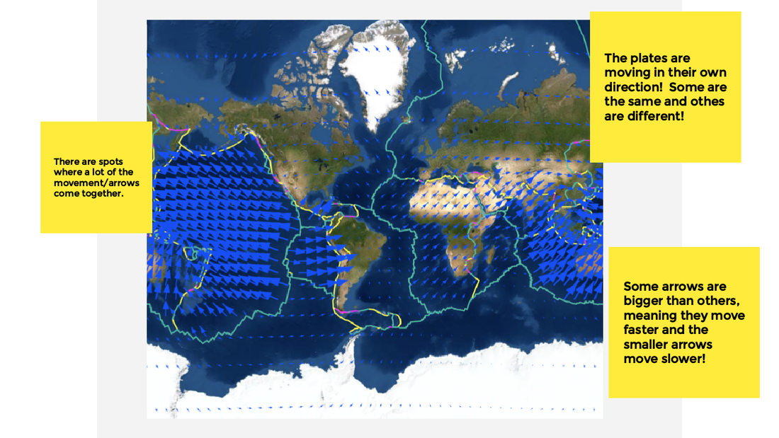
Our physical models have showed us just what the plates can do, even when you're on the edge or in the middle of the plate. We worked towards consensus after seeing some really interesting things from a plate movement map! We're also seeing some other interesting things on the plate movement map, and these ideas include: 1. When plates move away from each other. 2. When plates have one with a TON of energy right next to one that has a lot less. We're seeing fast moving plates next to slow moving plates basically! After some research comparing three locations that were of interest to us, we say some interesting things! In each of these locations we saw something quite interesting! Volcanoes were forming near the plates that had a fast one next to a slow one, and volcanoes weren't forming where plates were separating (like we originally thought they would). With some research, we came to an agreement about what happens when plates with this new type of movement interact with one another! 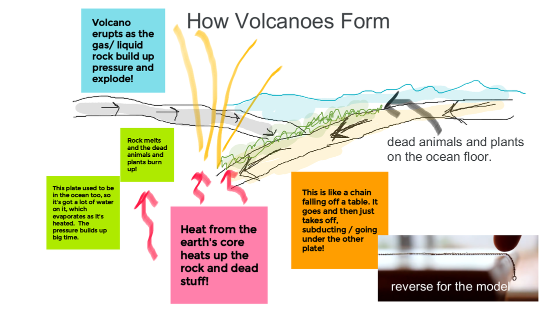 So now that we know so much about plate movement, we're wondering a whole bunch of things as they relate to Mt. Everest!
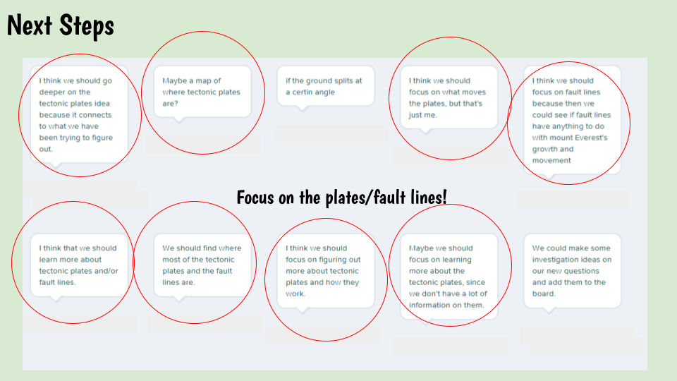
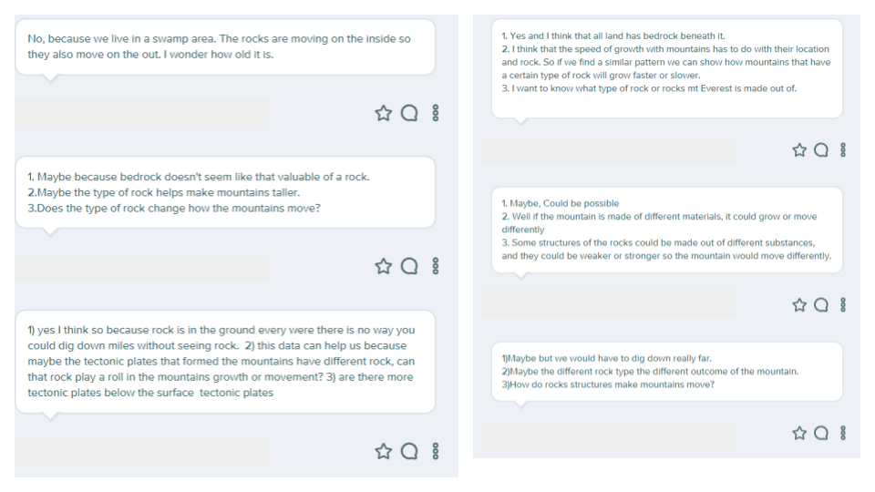
1. How is it that Mt. Everest has both limestone and basalt on it? It's not near the ocean where limestone comes from (shells) and where we tend to see volcanoes (basalt is a type of volcanic rock)? 2. If Mt. Everest is moving to the NE, this means it was once farther SW, right? How can we show this? So if we see a changing landscape, we're really wondering about how these plates are moving! We have specific data on various locations--like how many centimeters it moves each year and the direction it goes. When looking at an entire plate boundary map with this data added to it, we saw some incredible things! Putting some pieces together, we realized we wanted more information on where these HUGE plates were getting their energy from to move. So we turned to an article that helped us collectively model what's going on if you were to dig past the deepest mine! 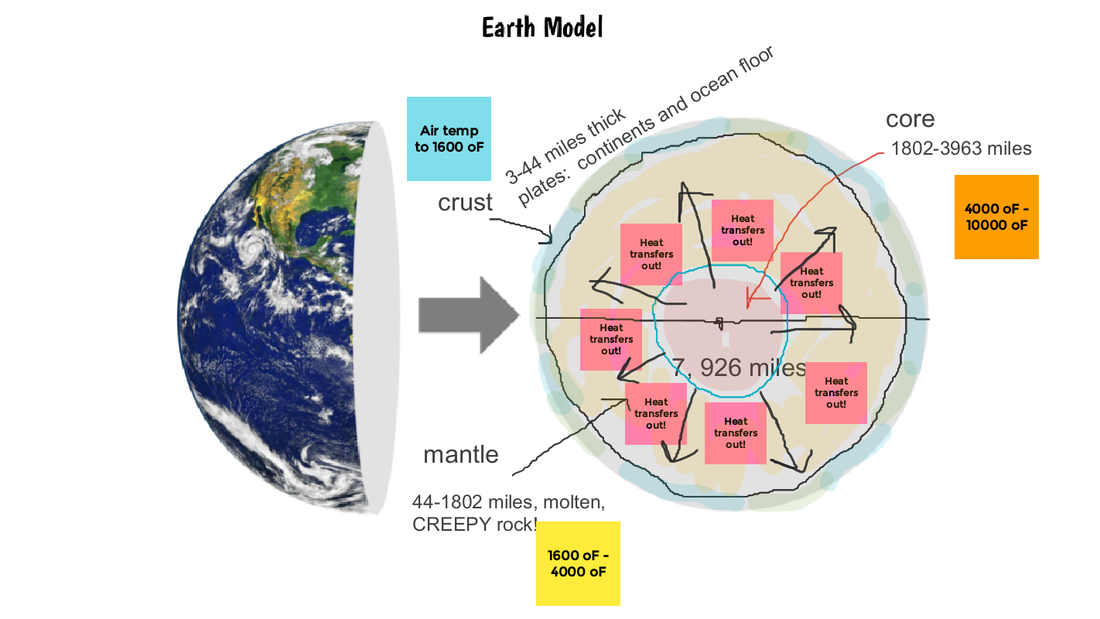 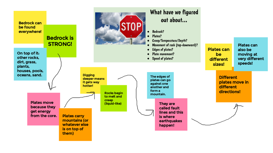 Creating a summary chart, we are seeing how when different plates, which are made of different materials, move in different directions at different speeds, we're bound to end up with something happening on top of the plates--whether that be sediments, plant life, water, or continuous bedrock in a mountain! We took whatever we had around us in the classroom or in our learning spaces remotely to see what we saw on the map...plates coming towards one another, plates sliding past one another, and plates moving apart from one another.  We saw rock that was bending before it broke, plates slipping on top/under one another, big shifts or even high raises in the plates. We realized there were some drawbacks to what we were using, but we're starting to see how the various movements of these plates is causing some interesting patterns on the surface. How can we use these ideas to explain what's happening on Everest and each of our other locations that experience earthquakes, too? We've got more figuring out to do!
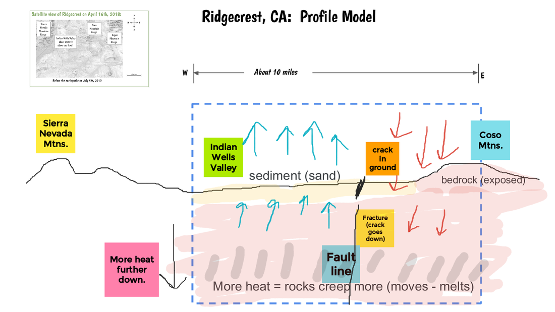
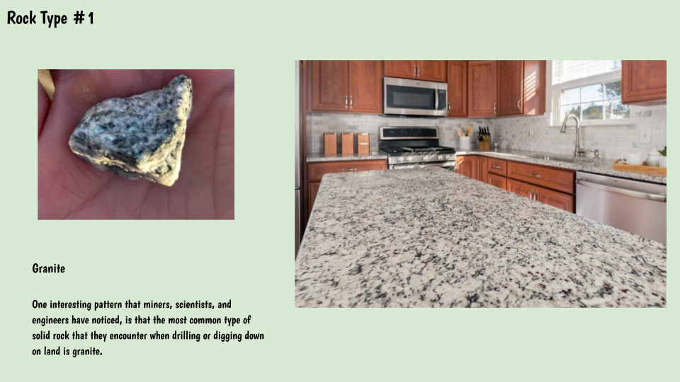
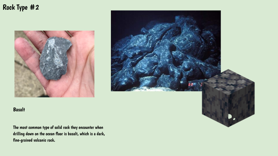
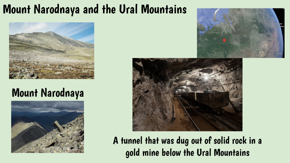
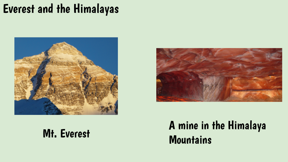
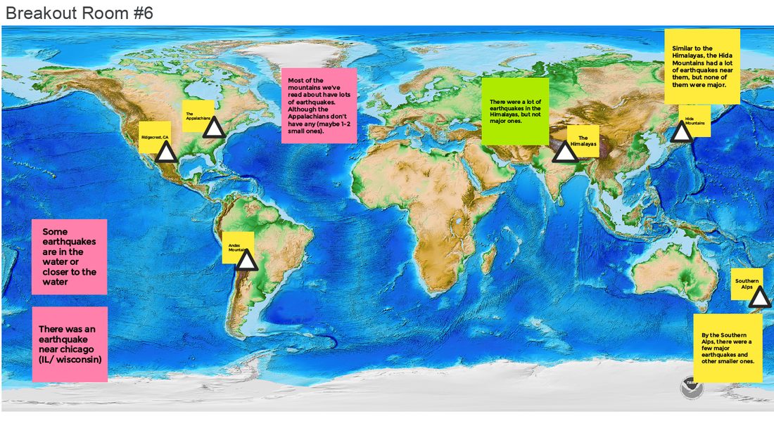
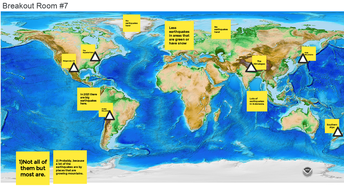
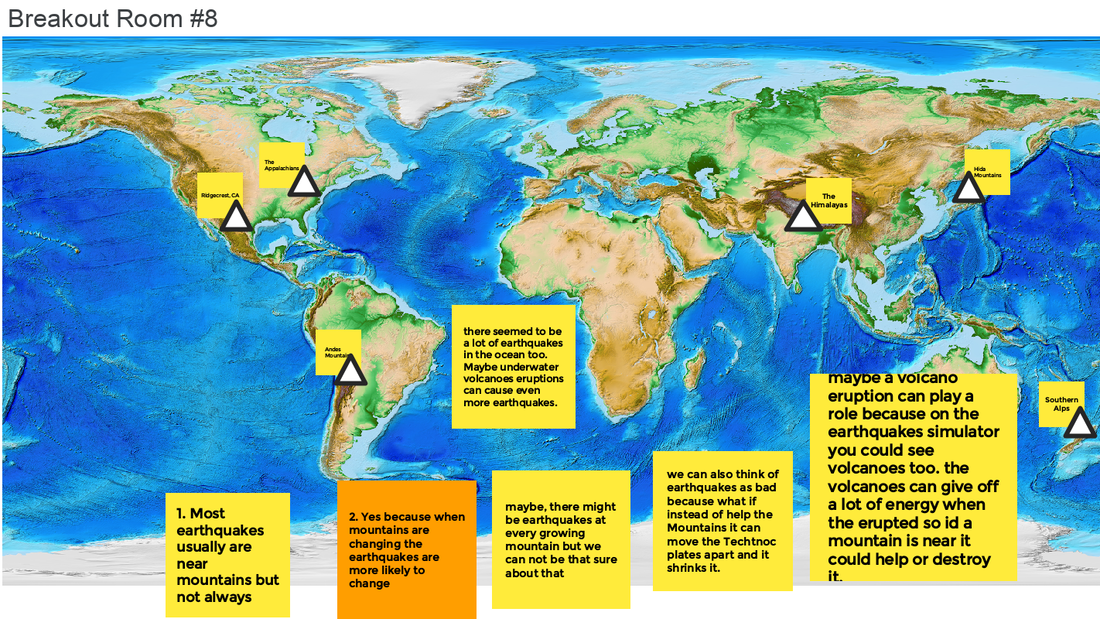
Now that we've figured out how heat affects rocks, we're turning back to our earthquake map and data on both Mt. Everest and Ridgecrest, CA. We are seeing that earthquakes can leave cracks in the ground, and that these cracks must go deep into the ground if parts of the land rise up and others move downward. With the help of an earthquake simulator and lots of data from aerial pictures of what happened at Ridgecrest, we've built out two models: 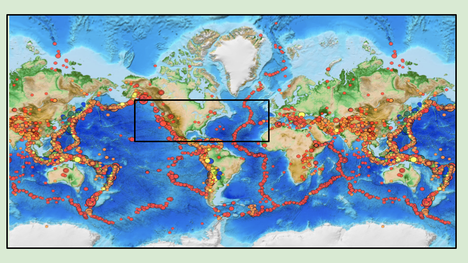 We've got so many questions around what's going on at these fault lines, or where the plates (large pieces of bedrock) seem to be moving! With our new questions and our next steps planned out, it seems like we're really thinking about what those plates do! So with all this wondering about what is going on below the surface (even here in Chicago), we turned to some research to help us figure out what's going on below the ground, as we looked at some mining pictures and videos. Here's what we figured out: 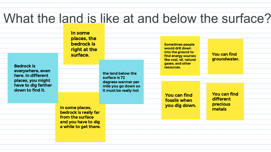 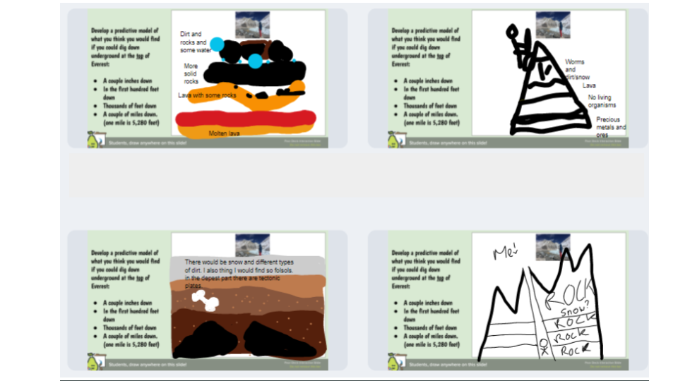 We began thinking about what is below the surface is impacting what's above the surface, and we began thinking about various rock types and how they respond to heat! Mrs. Brinza ordered some rock samples, and we saw what happened with these rocks!
We're seeing a whole bunch of things:
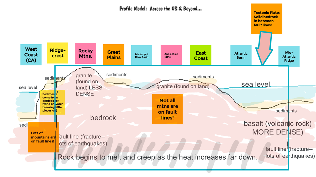
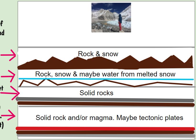
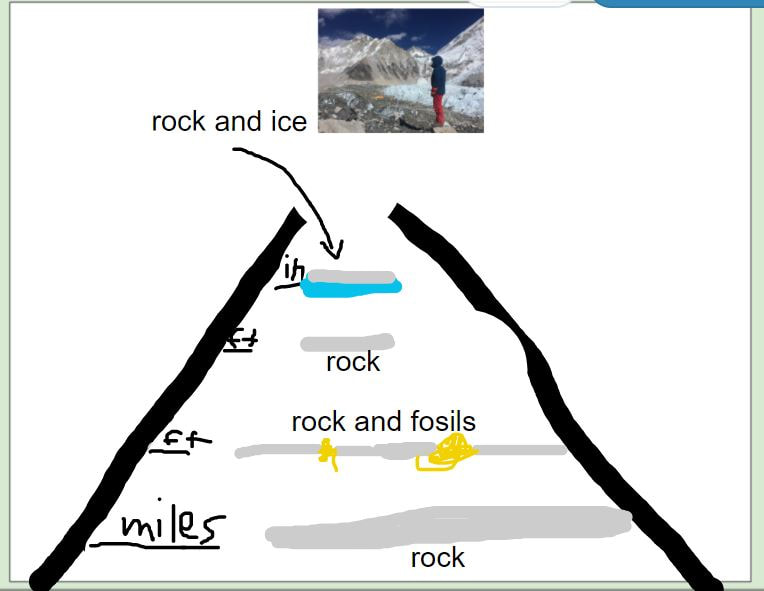
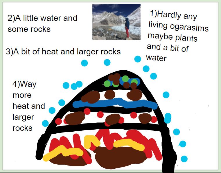
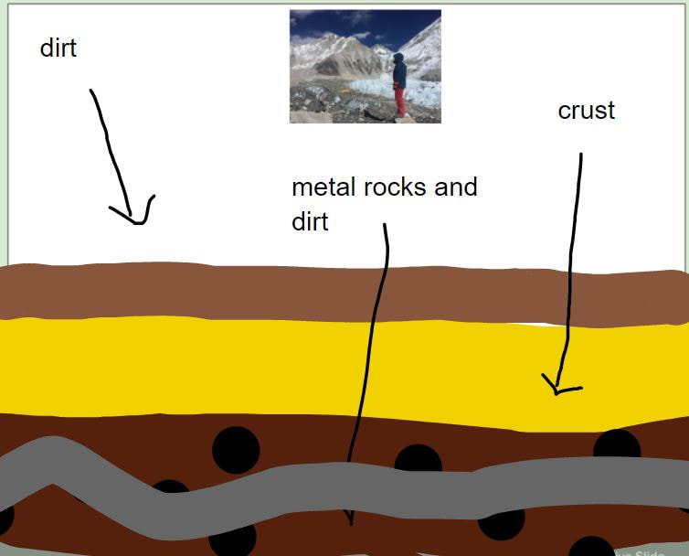
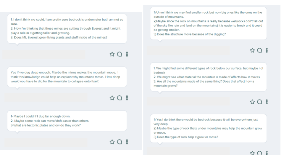
1. Some rocks are certainly softer than others. 2. When we heat rocks, they begin to act like liquids, so we think that rocks can absolutely melt! We figured out that when rocks begin to move and behave like liquids, this term is called creep! More heat = more creep! So the deeper you go, the bedrock creeps more! Recognizing that something below the surface is happening to get the landscape above the surface to change, students were asked to develop a model that would show what they would find at different depths (from at the top of Mt. Everest):
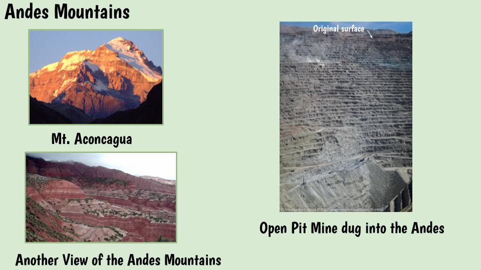
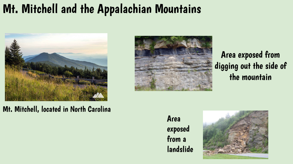
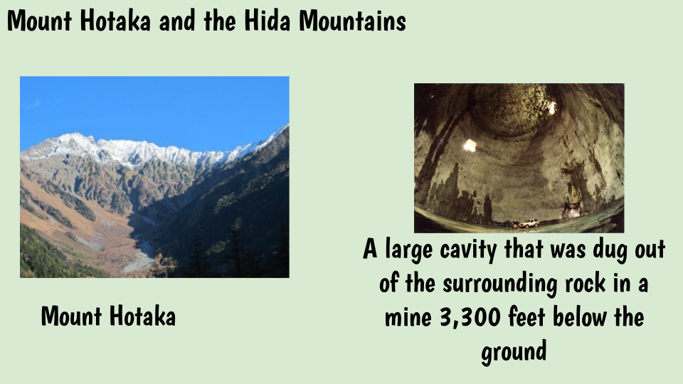
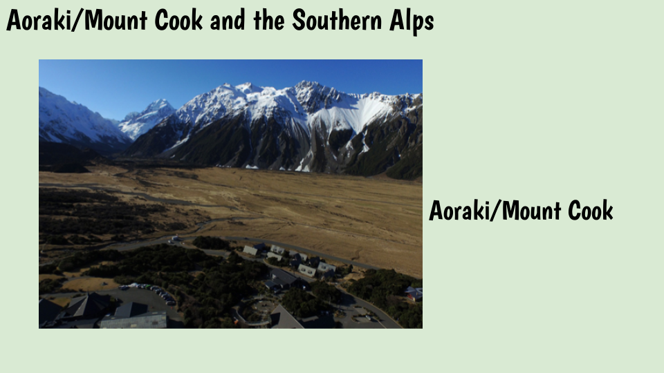
*Here are some students' thoughts! We then wanted to see real footage below the surface, especially at some of the locations we are already invested in. Many of these places have photographic evidence below the surface, which was interesting to see! Between the different heights of mountains, we're also seeing lots of layers below the surface in the mines/dig-outs below the mountains. While we were thinking about all these other locations, students were asked to consider where they live! 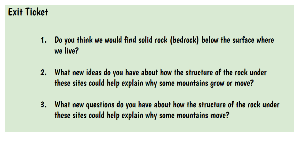 We've got so many things to think about/figure out! See you after spring break!
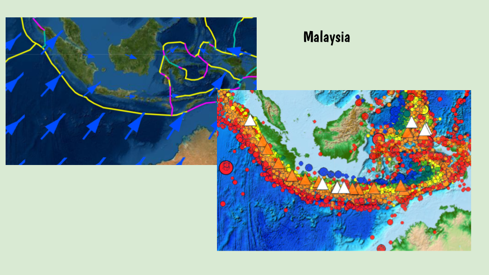
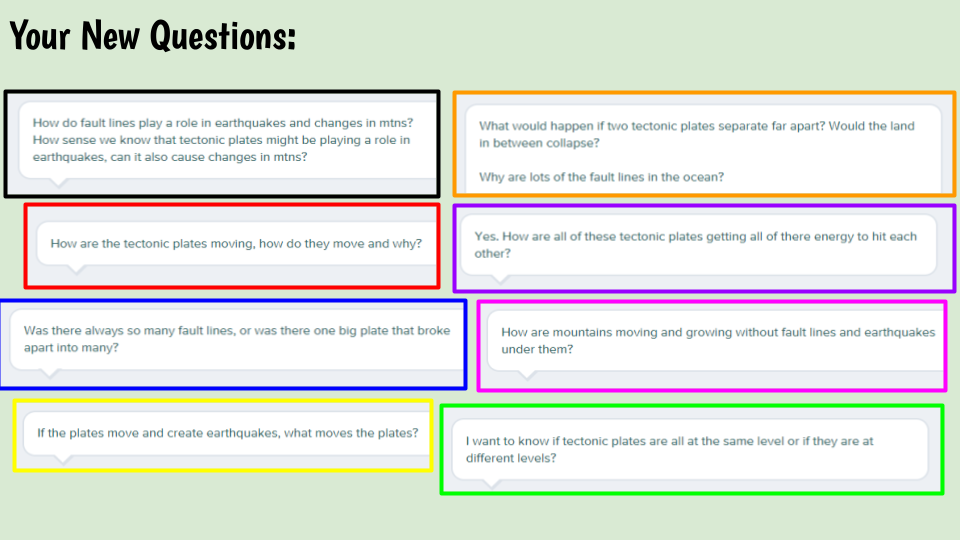
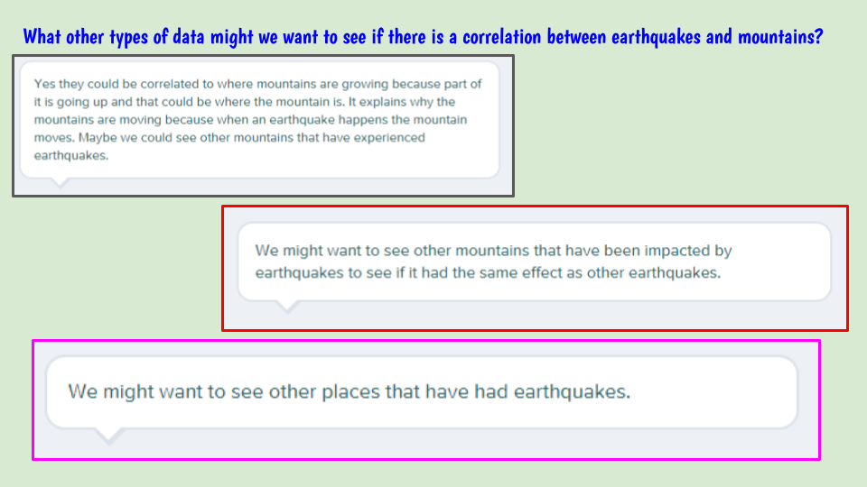
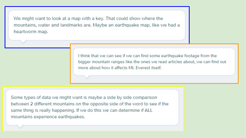
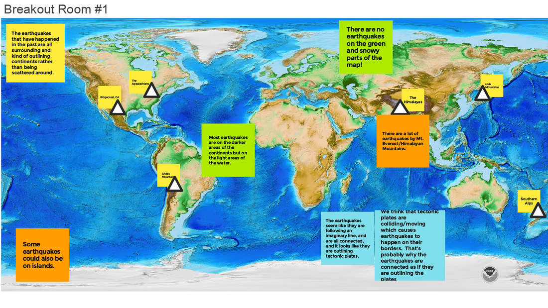
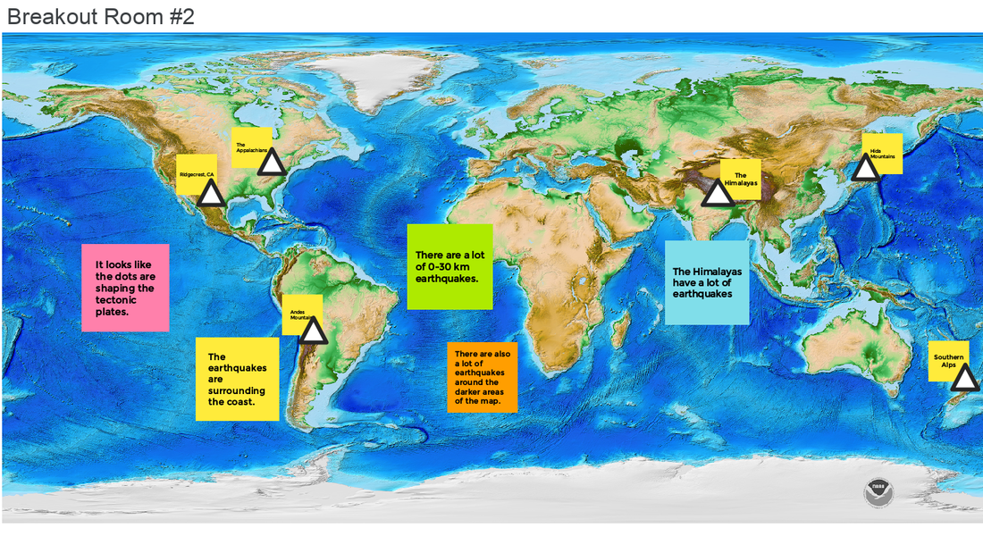
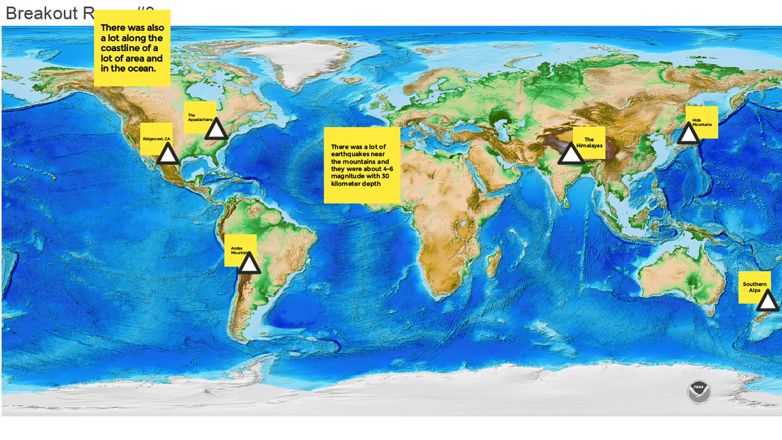
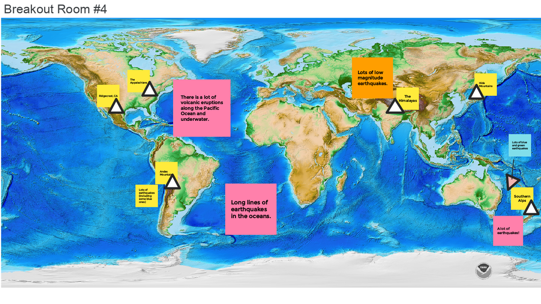
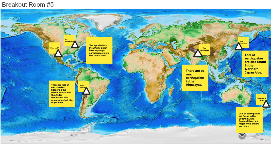
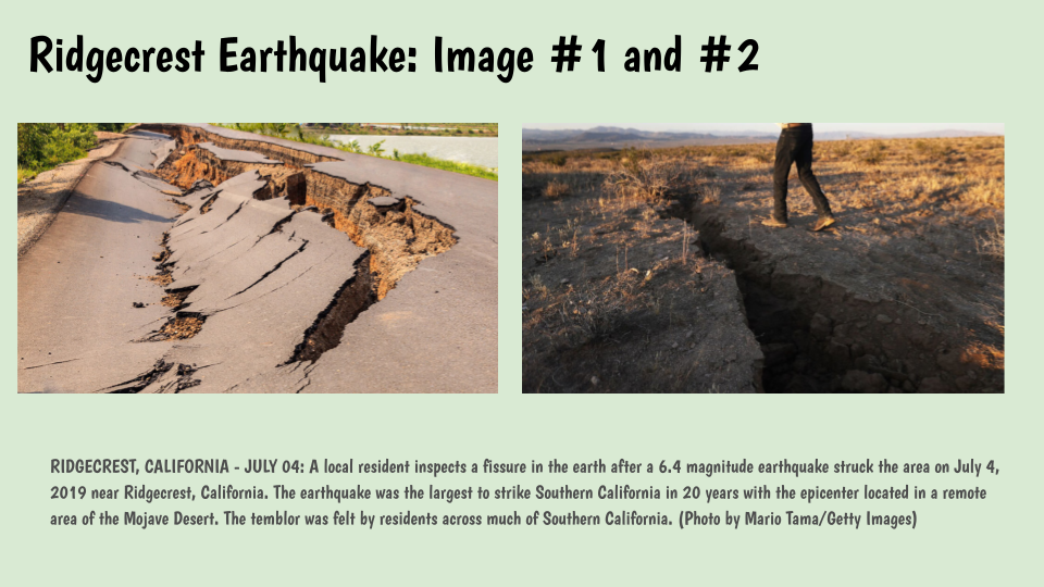
With all these curiosities flying around over earthquakes, students were asked what new pieces of data they wanted and it was an overwhelming consensus for more data on earthquakes! We're seeing that earthquakes are happening all over the world, ALL the time, and are different magnitudes and depths! Using the Seismic Explorer proved to be VERY helpful! Students began seeing some amazing things here! 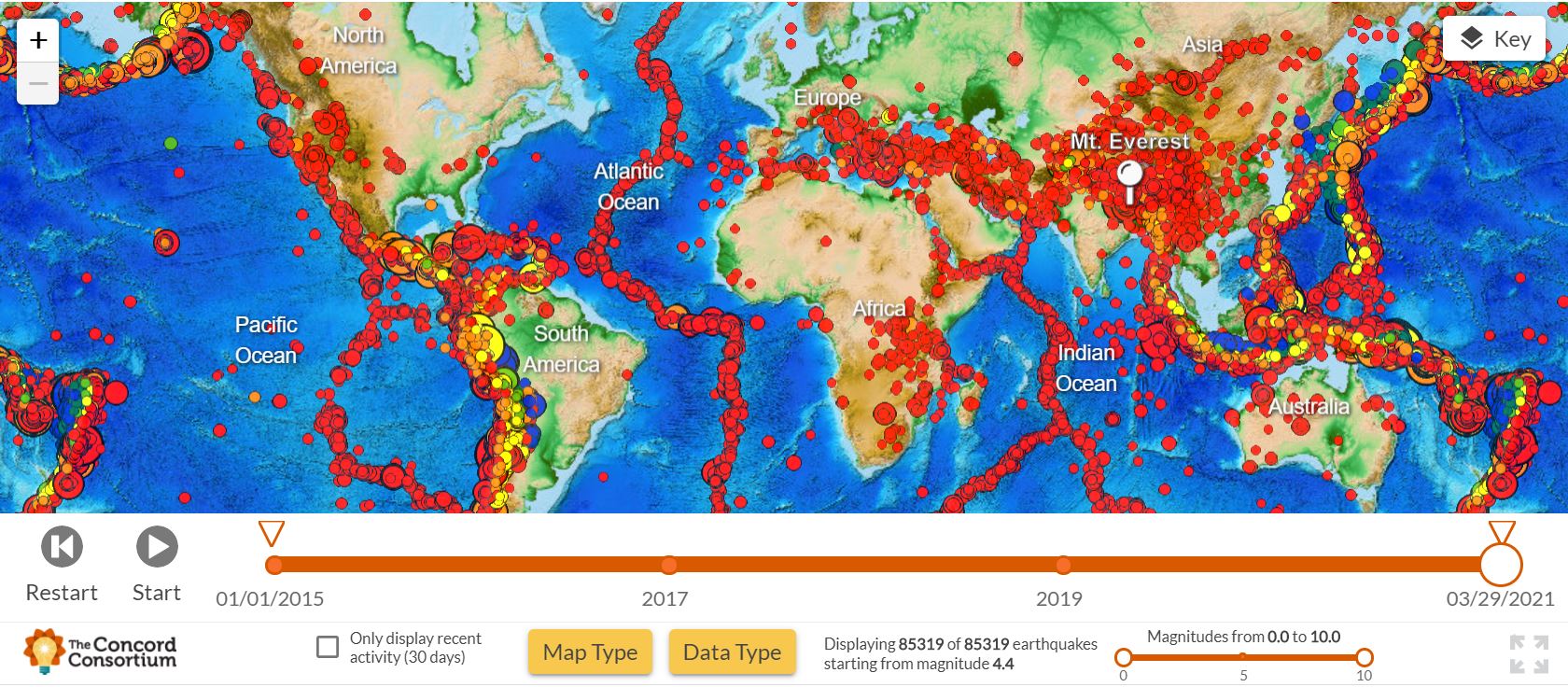 So with all this usage of the seismic explore, we're thinking that the earthquakes seem to be happening maybe at the edges of plate boundaries. But the interesting thing is that we don't really know what's below the surface, as this is the part we can't see, but may be causing all this change on the surface! 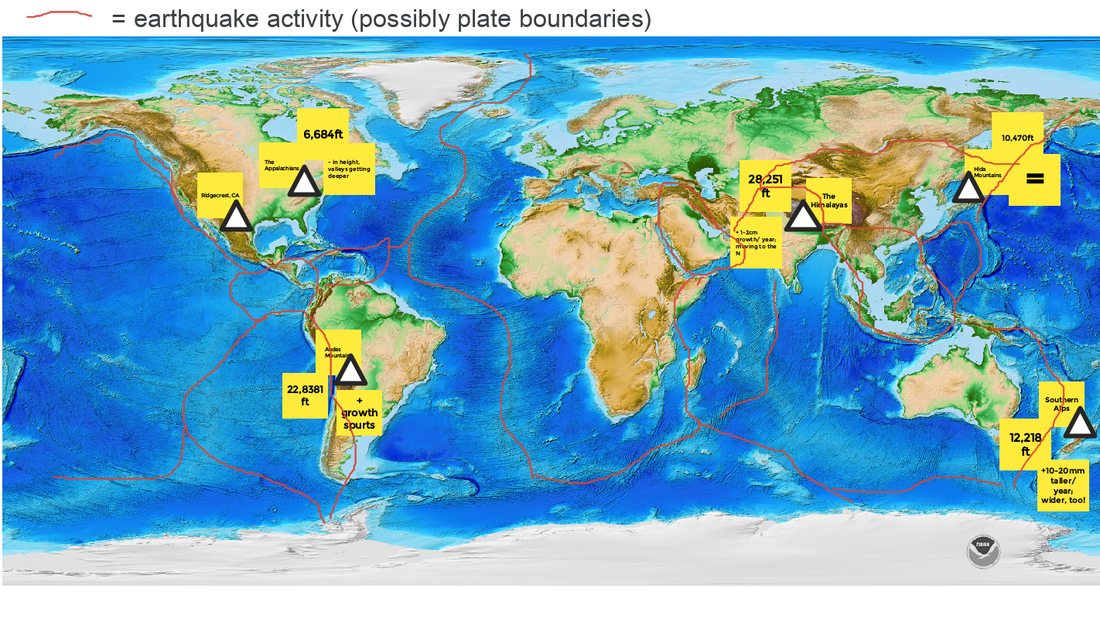 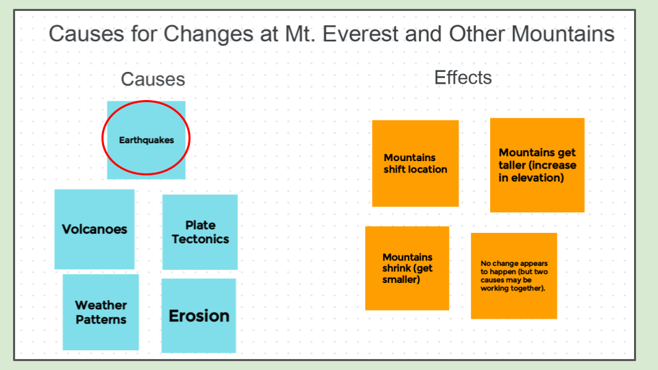 We recognized that the big earthquake on Everest back in 2015 could possibly be the cause of the mountain growth and shift (maybe even the decrease in height, too)! So we decided to start with this possible cause since other mountains experience earthquakes, too! We watched a few videos to see firsthand what experiencing an earthquake might be like:
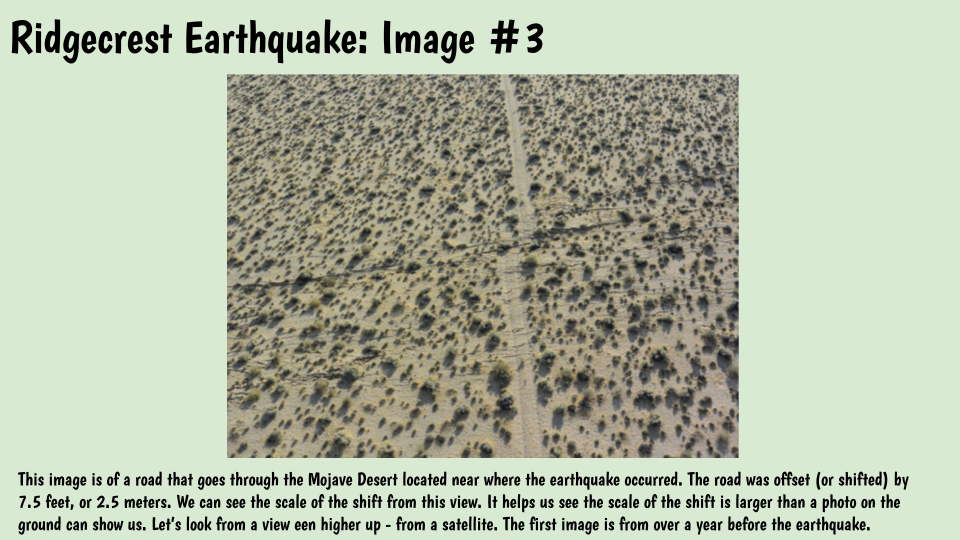
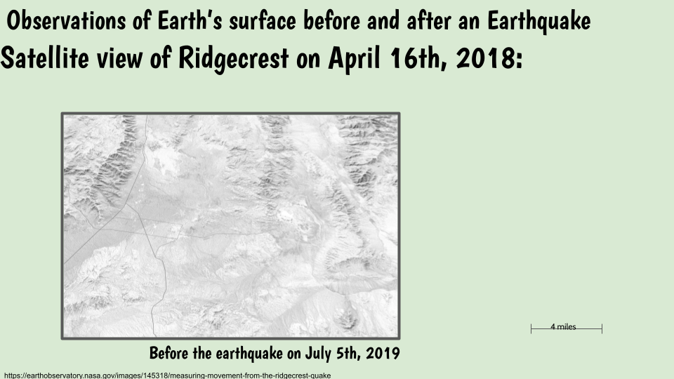
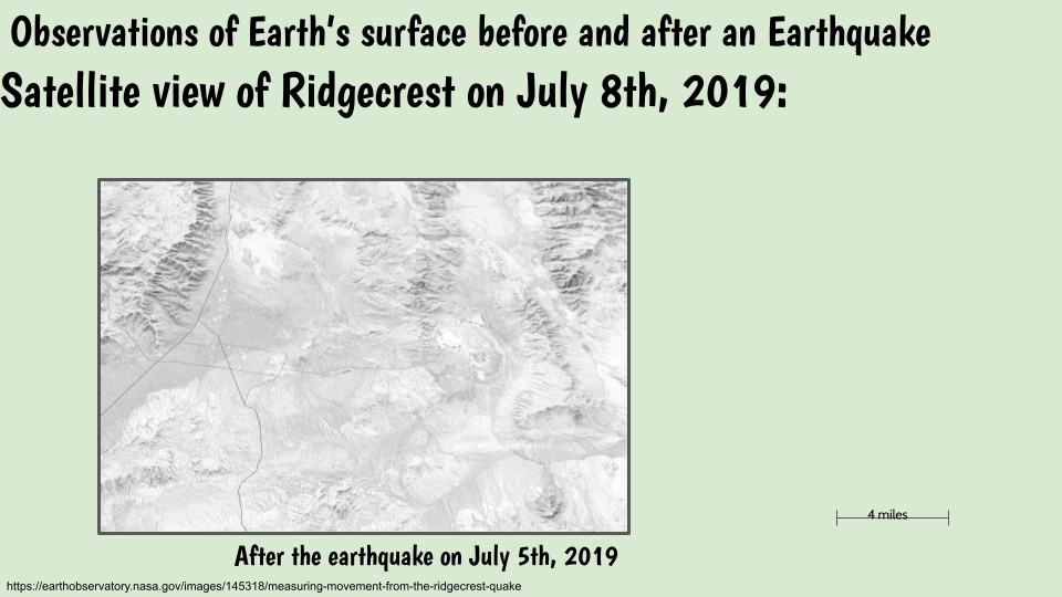
Not only did we have videos to see, but some pretty interesting photographic evidence from the Ridgecrest Earthquake in 2019. 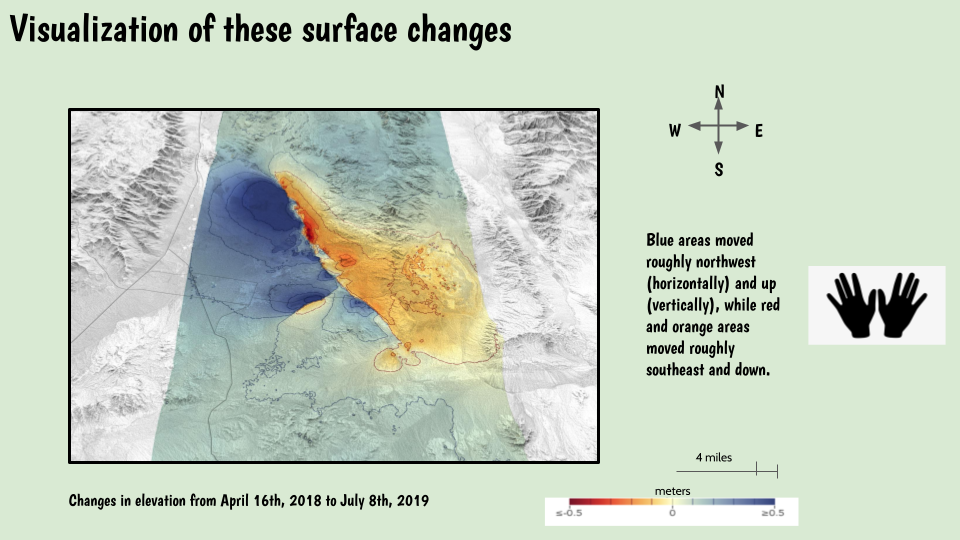 There were so many things to see from these photos! From large cracks/splitting in the earth's surface, to the layers below, we also are seeing that there are different colors in the layers. Students are also wondering if the split road is because something (maybe a plate) went up, but is it because the other part/plate went downwards. From the satellite pictures, we see an obvious change in elevation (a careful toggle between pictures shows a light/dark comparison in the middle). Gosh we have so many questions! We turned to our investigation ideas after seeing these pictures! We are wanting more information on earthquakes since these photos seem to show us a LOT!
|
Mrs. BrinzaThere's nothing like seeing the vastness of a mountain before eyes! Archives
May 2021
Categories |


 RSS Feed