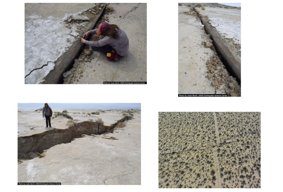
We've seen firsthand the evidence left behind of a similar earthquake to the big one at Mt. Everest not terribly far from us in Ridgecrest, CA.
We've also seen how satellite data has suggested that part of the area near Ridgecrest has increased in elevation and how part of the area has moved a different direction.
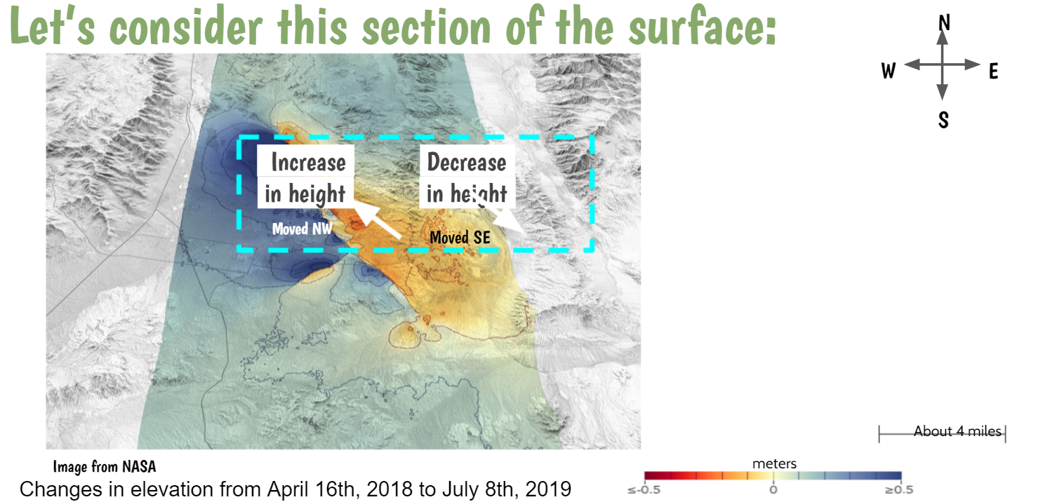
We're trying to see how this increase/decrease in height can possibly happen, especially after we've figured out that all over the Earth is solid rock, known as bedrock. How is it that it can just "break" when it's so solid?
Over the weekend, Mrs. Brinza was looking for a material that can show us how materials can behave under large amounts of movement (think about how the rock below the bedrock is heating and gradually creeping). Using some foam insulation as a model for bedrock (with no sediments on top of it, of course), here's what we saw!
Over the weekend, Mrs. Brinza was looking for a material that can show us how materials can behave under large amounts of movement (think about how the rock below the bedrock is heating and gradually creeping). Using some foam insulation as a model for bedrock (with no sediments on top of it, of course), here's what we saw!
We saw:
1. Rock bending until the point it "snapped!"
2. A big loud "POP!" similar to what we heard from the live footage at the basecamp of the 2015 Mt. Everest Earthquake.
3. A break in the rock that was jagged/organic. We are thinking that this break in the rock is a fault line and the breaking of the bedrock was the earthquake!
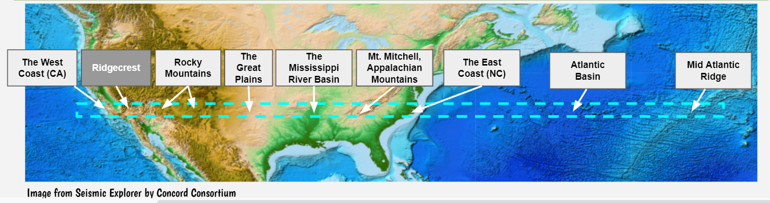
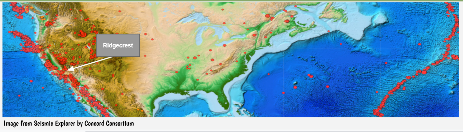
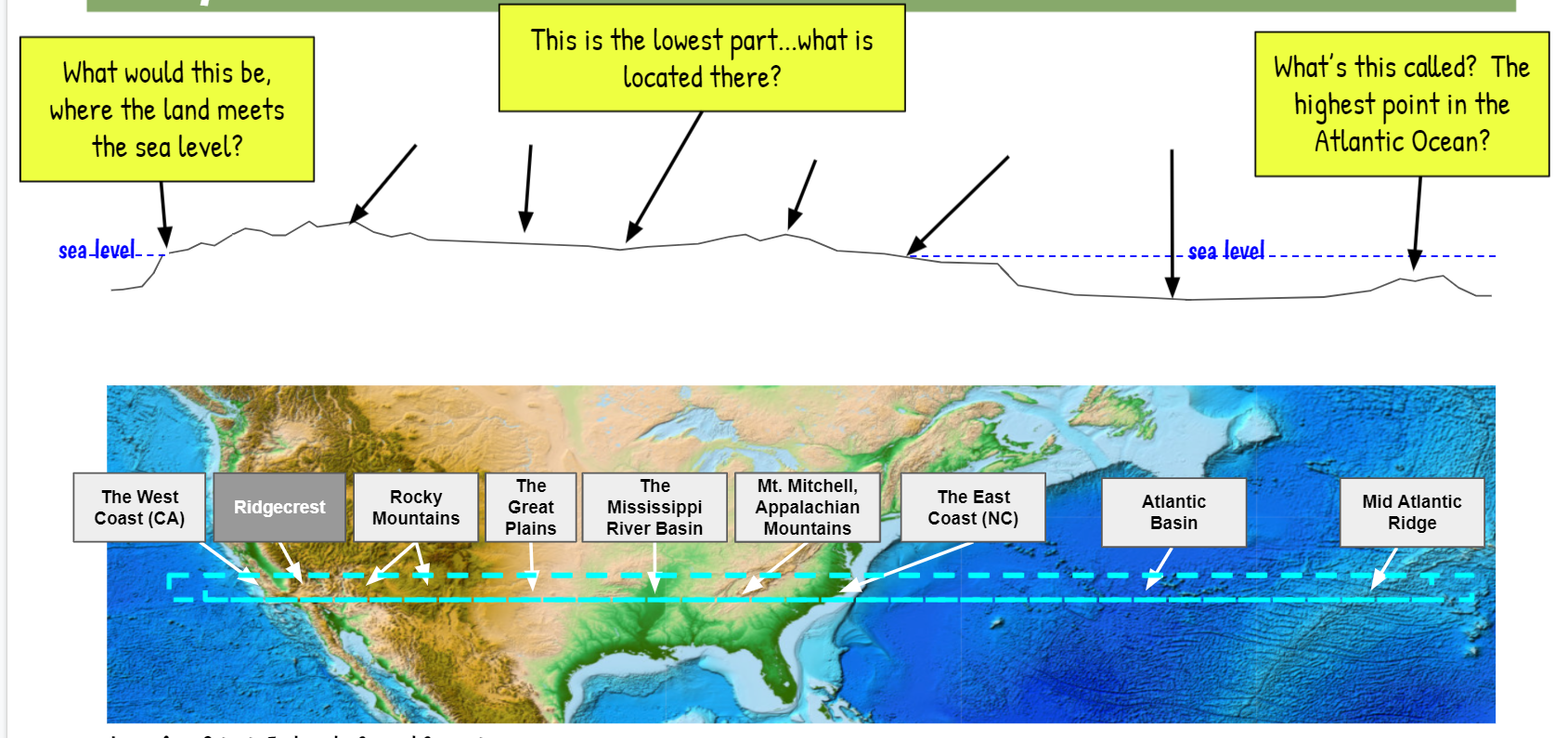
We turned back to our map to begin thinking about various landforms near and around Ridgecrest, including where the nearest sets of earthquakes were. Here's what we saw:
a. The nearest sets of earthquakes to Ridgecrest were just to their west and VERY FAR away to the east, concentrated in the Mid-Atlantic Ridge.
b. The topography of the land change tremendously from the Rockies, to the Mississippi River Basin, to the Appalachains!
1. Rock bending until the point it "snapped!"
2. A big loud "POP!" similar to what we heard from the live footage at the basecamp of the 2015 Mt. Everest Earthquake.
3. A break in the rock that was jagged/organic. We are thinking that this break in the rock is a fault line and the breaking of the bedrock was the earthquake!
We turned back to our map to begin thinking about various landforms near and around Ridgecrest, including where the nearest sets of earthquakes were. Here's what we saw:
a. The nearest sets of earthquakes to Ridgecrest were just to their west and VERY FAR away to the east, concentrated in the Mid-Atlantic Ridge.
b. The topography of the land change tremendously from the Rockies, to the Mississippi River Basin, to the Appalachains!
We imagined digging into the blue box around this cross-section and turning it on its side to predict what things would look like. We considered where various rock types would be based on their densities and that you find bedrock everywhere. We're also considering the sediments we find in these various places!
Check back to see our sense-making in action! If all this area has bedrock above and below, and earthquakes happening on the edges, what's this solid piece of bedrock called? Are parts of it exposed? Are other parts deep underground? What happens when one section of bedrock rubs against another as it creeps? All these questions!
 RSS Feed