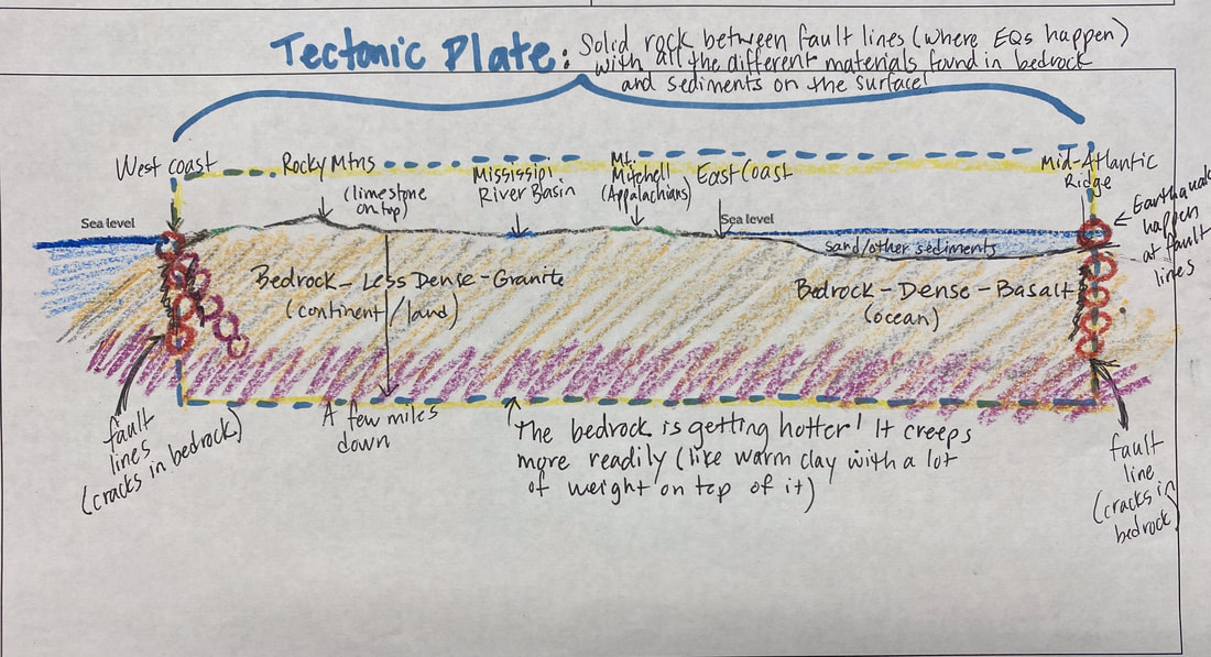
After using the foam insulation as a model to see what happens when bedrock is under extreme pressure (like at Ridgecrest where it went up on one side and down at the other), we began putting some pieces together to recognize that where the bedrock splits is a faultline, and that earthquakes are happening there!
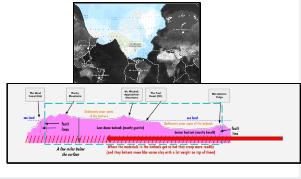
We officially defined a plate from our experience, seeing that we are situated right in the middle of the North American plate, bounded on the west by the coast (Pacific Ocean) and to the east all the way in the Atlantic Ocean where the underwater mountain range is--the Mid Atlantic Ridge (we think it's a mountain because of the relief map's coloring).
We officially defined a plate from our experience, seeing that we are situated right in the middle of the North American plate, bounded on the west by the coast (Pacific Ocean) and to the east all the way in the Atlantic Ocean where the underwater mountain range is--the Mid Atlantic Ridge (we think it's a mountain because of the relief map's coloring).
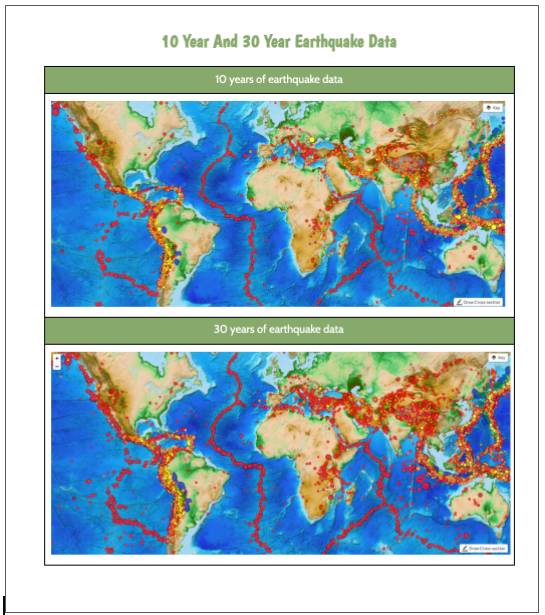
Since earthquakes are bounded by fault lines, we're seeing how there are possible fault lines and LOTS of other plates all over the world. We mapped out where we think plates are, to see that there can be lots of disagreement on how many plates there are!
Students were asking for more data, as they were seeing how this plate map has movement on it (when we originally looked at mountain cases, we saw how mountains all over were moving)! Since we know various mountains move, the plates that they're on must be moving, too! But how?
Looking at the plate where we are, we're seeing how different parts of the plate are moving at different directions and different speeds. But why? What's going on below the plates that causes this movement?
Looking at the plate where we are, we're seeing how different parts of the plate are moving at different directions and different speeds. But why? What's going on below the plates that causes this movement?
 RSS Feed