We know that the temperature of the Earth gets hotter and hotter the deeper you go, and we're curious how this relates to the movement of plates. This is especially true as we figured out how rocks can creep.
With some research, we figured out about the Earth's three main layers and how the temperature changes DRASTICALLY as you go deeper!
With some research, we figured out about the Earth's three main layers and how the temperature changes DRASTICALLY as you go deeper!

We were really wondering what the heat does, so we set up a physical model in class to see a few things:
1. What the heat does from the core outwards.
2. How the plates can be moving at different rates and directions at the same time.
1. What the heat does from the core outwards.
2. How the plates can be moving at different rates and directions at the same time.
| | |
From our investigation, we figured out the following:
a. Heat from the core goes upwards and then outwards.
b. The heat isn't evenly distributed--some areas were moving really fast, while other areas were moving really slowly.
c. The materials we used for plates (aluminum foil, basil, and crushed red pepper) certainly moved on top of the water (which was a model for the mantle), and they moved at different speeds and different directions!
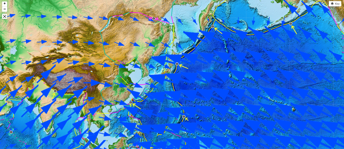
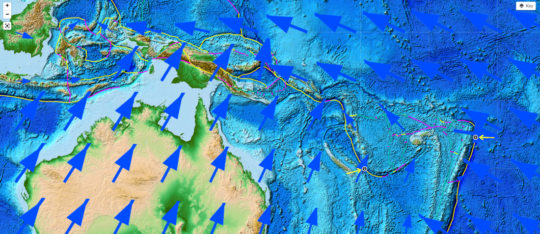
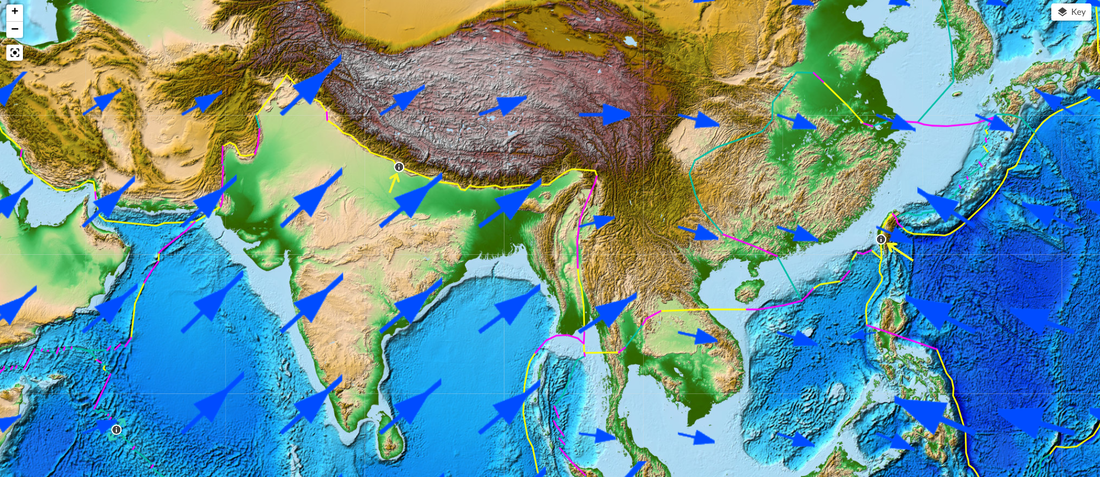
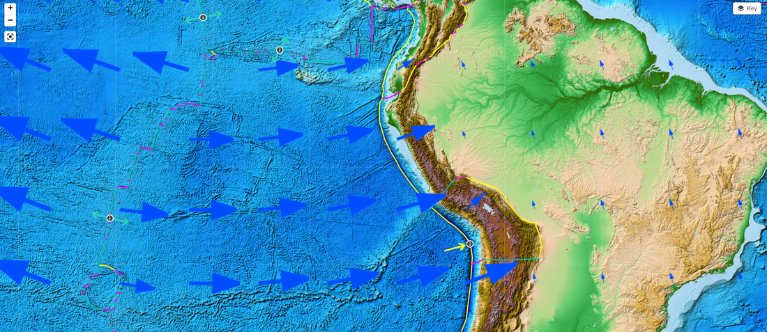
From here, we went back to the Seismic Explorer, this time focusing on GPS data on all the plates to see what we figured out in our models was evident in real life!
a. Heat from the core goes upwards and then outwards.
b. The heat isn't evenly distributed--some areas were moving really fast, while other areas were moving really slowly.
c. The materials we used for plates (aluminum foil, basil, and crushed red pepper) certainly moved on top of the water (which was a model for the mantle), and they moved at different speeds and different directions!
From here, we went back to the Seismic Explorer, this time focusing on GPS data on all the plates to see what we figured out in our models was evident in real life!
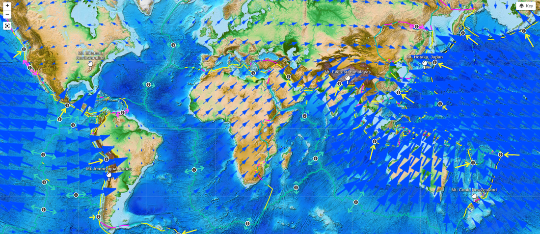
Some parts of the map were super interesting to us. Looking closer at specific areas, we saw how there was some drastic differences between plates that were right next to each other. We're trying to use this data to make sense of why:
1. Some mountains have more growth than others.
2. Some mountains are shifting in various directions.
3. Why some places have more earthquakes than others.
4. How the depth of earthquakes can be different based on plate movement data.
5. Plates of different densities may result in different events.
1. Some mountains have more growth than others.
2. Some mountains are shifting in various directions.
3. Why some places have more earthquakes than others.
4. How the depth of earthquakes can be different based on plate movement data.
5. Plates of different densities may result in different events.
So if all these areas have different movements, maybe we should see what happens when plates of various sizes and densities interact with each other. Would this help explain why the land looks so different yet similar in each of these locations?
 RSS Feed