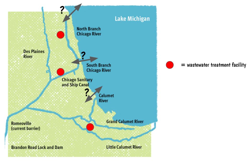
 | Now that we know the closest waterway to each of the wastewater treatment facilities here in Chicago is the Chicago River, we looked at the map of the river system here in Chicago. There are many parts that seem to connect. We're so close to Lake Michigan, too, that we're really thinking that the water from the river must go there...but how does water flow? |
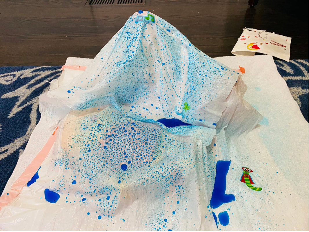
With Mrs. Brinza's help, we built out a landscape with some garbage bags and some toys she had laying around in her remote learning workspace (her kids' playroom)! We added water to it to see what would happen. Here's what we noticed:
1. Water always goes down to the lowest point.
2. It seems to pool where there's no slant.
3. Water droplets join other droplets and kind of make rivers downwards at they flow.
While we initially thought wind got water flowing (and it might), Mrs. Brinza had no wind in her playroom, so we're thinking that it's just the slope that gets water flowing.
We decided the best way to figure out how the water flows in Chicago (like which direction) was to see if the land was sloped, and we're thinking it's not since Chicago is so incredibly flat. But with some elevation data for Chicago and surrounding areas, we're seeing that the land is actually sloped, which means the water does have to flow!
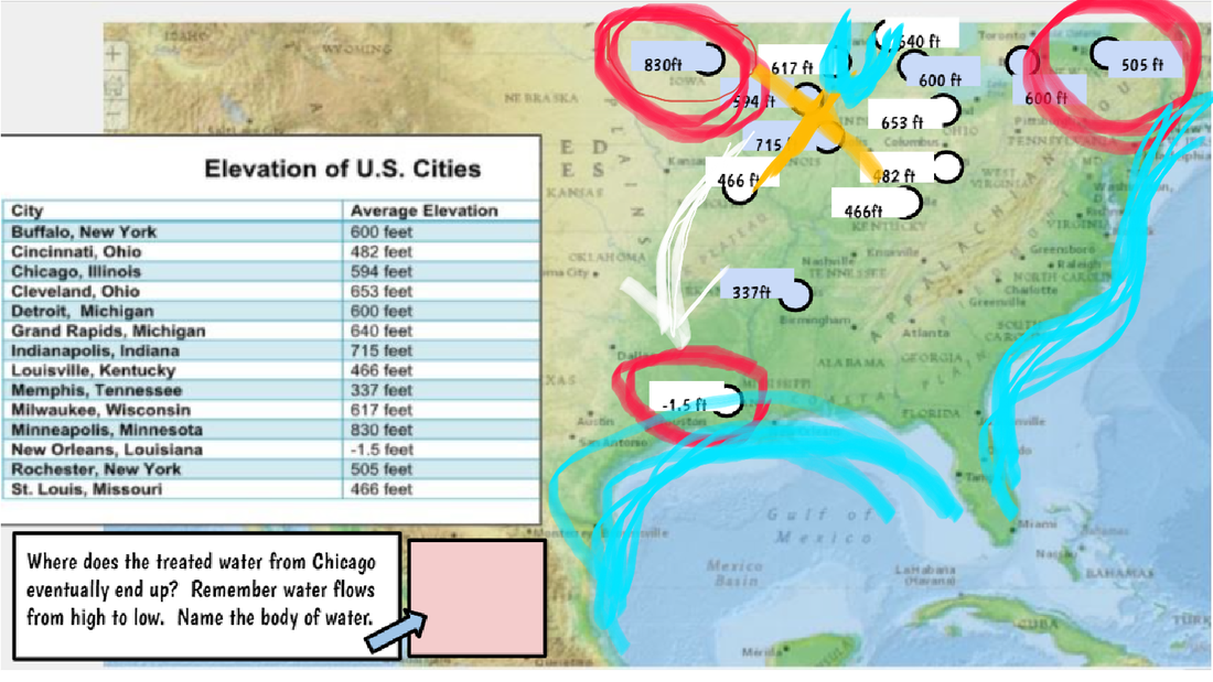
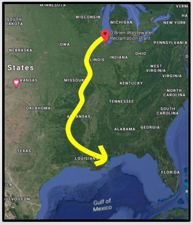
With all the data, we see how the water is flowing towards the Gulf of Mexico, and using Google Maps, we confirmed this! But now we're thinking...what does this really mean? Doesn't all our treated water, that's 99% clean from our wastewater treatment facilities end up in a body of water that has salt in it? What does this possibly mean?
 RSS Feed