So after summarizing what we've figured out so far in regards to mountain growth and relocation, we returned to our DQB to see that we still had questions left unanswered. We have some questions regarding both the future and past regarding Mt. Everest.

Using data near Everest can be tricky, since the plates creating Everest are going in many directions and are quite complicated. Instead, we turned to the Mid-Atlantic Ridge. Since we know the Mid-Atlantic Ridge is pushing Africa and South America apart, and creating new ocean floor in between them along with trenches, volcanoes, and other landforms like fissures, we wanted to go back in time and see what it would look like if we went the opposite direction of where plates were going today.
However, just using plate movement data isn't enough. We considered geologic time, doing the mathematical analysis to see that these land masses (S. America and Africa) on their respective plates are moving at a rate of 48-56mm apart a year, it would take 125-146 million years to get back to when they would right smack next to each other!
This means that there wouldn't be ocean between them and we'd need to look at other data based on the continents. Here are the lists of data students came up with!
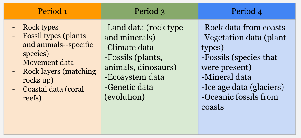
So with a bit of research, Mrs. Brinza came up with some of the data students requested, and using a bit of grit to cut and glue our evidence together, we seemed to have some data that better supported the positioning of S. America in relation to Africa about 145 million years into the past!

This wasn't enough--students suggested that we have GPS data from all the continents moving, so they want data on all the continents. Where exactly were they 146 million years ago? What data helps us better understand where they were? Will it be glaciers? Fossils? Rock layers? Mountains? Only time will tell!
 RSS Feed