We used the ArcGIS map found here to see our location compared to our nearest wastewater treatment plants. The images below are screenshots Mrs. Brinza took, and the green triangles are wastewater treatment plants. The blue note is where our school is located. We have a hunch that our treated water goes into the river that runs through our city, the Chicago River.
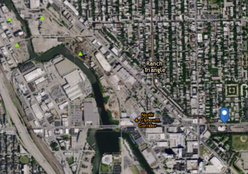
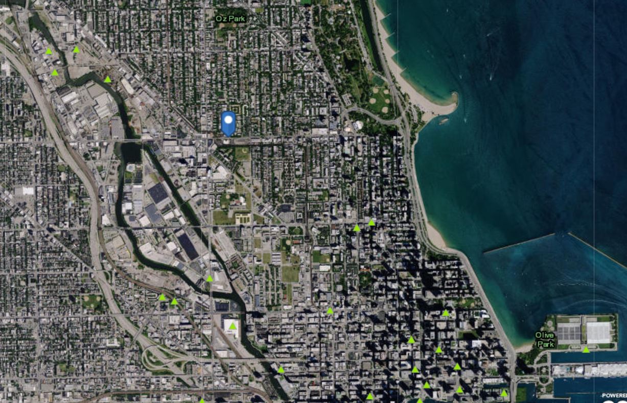
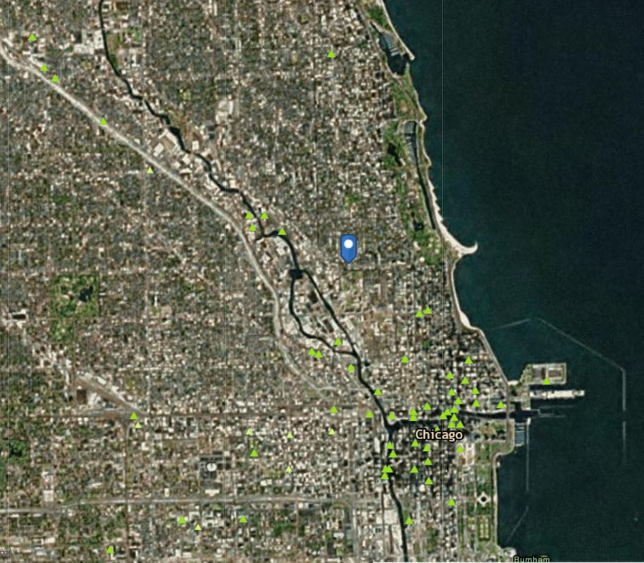
But we also noticed that some of the treatment facilities are located near Lake Michigan, and if we zoom out far enough see that the Chicago River connects to other rivers. This got us thinking...
1. How do these rivers and Lake Michigan connect, if they do at all?
2. Which way do the rivers flow, since there are so many of them?
3. Why don't the rivers keep overflowing if we dump the treated water there?
4. And if we get our drinking water from Lake Michigan like many students have heard we do, why should we care that the treated water ends up in the river if they don't have anything to do with one another?
We've got some investigating to do!!!
 RSS Feed