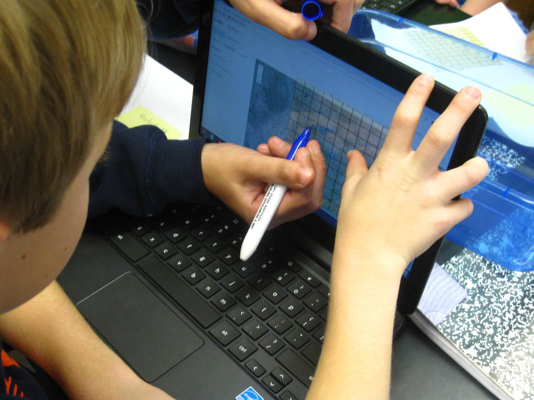
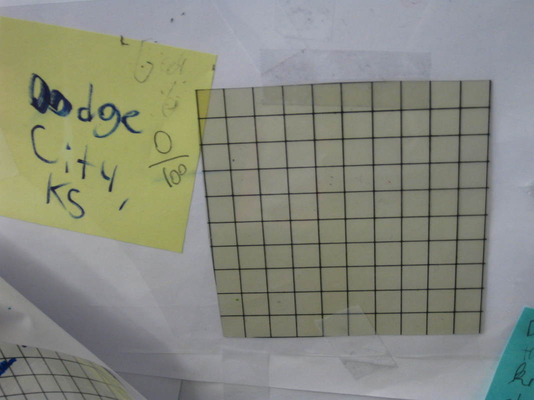
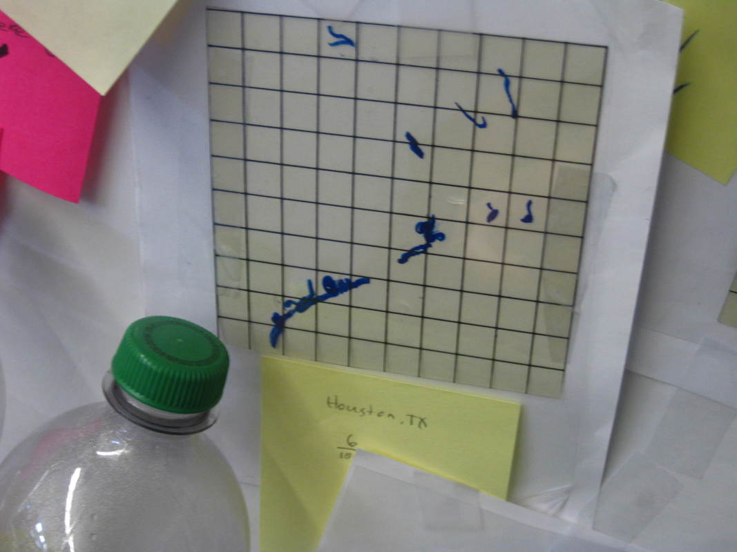
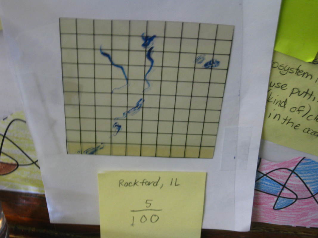
We realized that the ArcGIS maps can tell us a lot. They showed us changes in elevation, and can also show us street names and where wastewater treatment facilities are. We can also zoom in far enough to see if different places have fresh waterways near them.
So Mrs. Brinza gave students a whole range of cities, and students had to use the maps to figure out two things:
1. If there was any freshwater nearby.
2. And if so, how much of the area within a specific range was freshwater.
*They're not writing on the computer screens--but rather drawing on transparency grids on top of the screens!
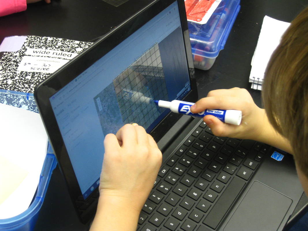
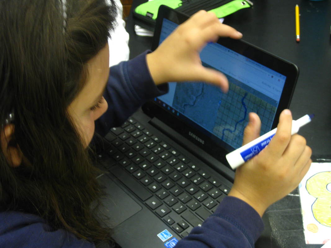
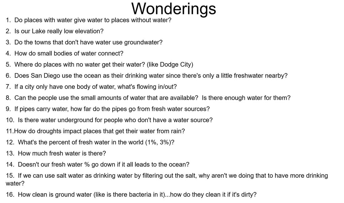
And from our map analysis...we had a whole bunch of things we noticed! These noticings generated a whole bunch of wonderings!
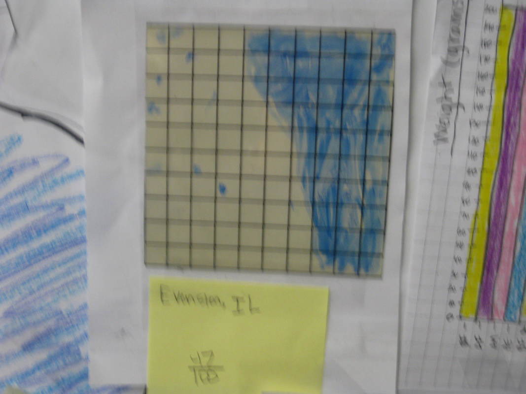
We figured out that there doesn't seem to be a lot of freshwater available in the US, at least around the cities we looked at. But the cities were everywhere in the US.
If you live by the Great Lakes, like us here in Chicago, then you're pretty lucky since the Great Lakes are REALLY big compared to other places. All this map work got us thinking though, and we generated some really good wonderings for our next investigations!
If you live by the Great Lakes, like us here in Chicago, then you're pretty lucky since the Great Lakes are REALLY big compared to other places. All this map work got us thinking though, and we generated some really good wonderings for our next investigations!

 RSS Feed